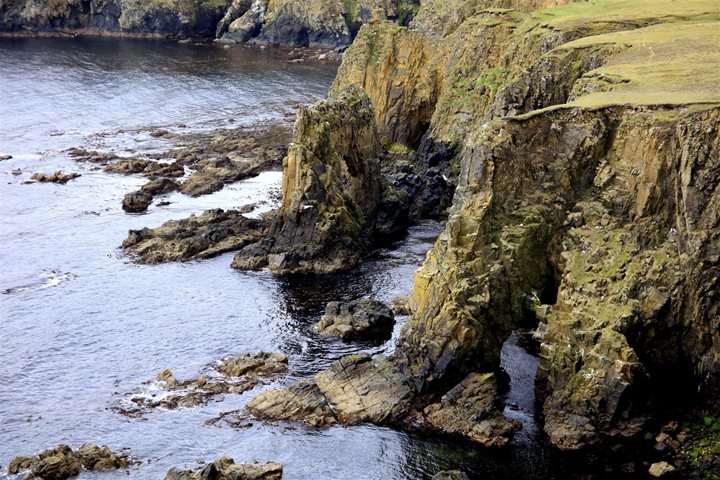


At around 6:00 a.m. this morning National Geographic Explorer arrived at the towering Cliffs of Moher in County Clare on the west coast of Ireland. These iconic cliffs rise 600 feet and stretch for five miles. The alternating layers of Carboniferous Period shales and sandstones have been sculpted by the incessant pounding of Atlantic waves into a myriad of headlands, caves, arches and stacks. Rock ledges offer safe nesting sites for a wide range of seabirds including guillemots, razorbills, kittiwake, fulmar and cormorant. In grassy banks close to the cliff top, puffins abound. Indeed the Cliffs of Moher are one of the most important, protected seabird colonies in Europe. Large rafts of birds were gathered on the water and, with huge numbers of others wheeling through the air, their combined cacophony of cries was a veritable avian concert.
These dramatic cliffs were once known as the “Great Wall of Thomond,” a reference to the famous O’Brien Dynasty of medieval times who ruled this area of western Ireland. This influential family owe their foundation to none other than the last great High King of Ireland, Brian Boru, who was slain by a fleeing Viking warrior at the end of the Battle of Clontarf, an historical event of huge significance in Ireland which celebrated its 1,000-year anniversary just last month.
Following breakfast we boarded the Zodiacs and landed in the harbour at Kilronan, the main village on Inish Mor, the largest of the three Aran Islands that lie off Galway. This is a celebrated archipelago which was immortalised in literature through the genius of J.M. Synge, a famous Irish playwright. A film made by the American director Robert Flaherty in 1934 showcased the traditional life of the Aran islanders and their daily struggle for survival with the sea. The film, Man of Aran, is a classic.
Small mini buses took us to our morning’s main visit, the prehistoric monument known as Dun Aengus. Located atop a 300-foot cliff on the south coast of the island, archaeological excavations have revealed activity on this site over a 2,500-year period. The main occupation was in the late stages of Ireland’s Bronze Age. A multi-period and multi-functional site, this ranks as one of the most impressive prehistoric monuments in Europe. The island is a karstic area with text book examples of limestone pavement, clints and grikes, fine examples of which we examined as we traversed the landscape. It has a unique combination of plants consisting of representatives from temperate, Mediterranean, alpine and arctic areas – a veritable botanical metropolis.
We returned to the ship for lunch and then spent the afternoon exploring the smaller sister island of Inisheer– and what a treat this was!! We were met on the quayside by a local transport provider who arranged for us to be taken in a variety of tractor-drawn vehicles and a mini-bus to a couple of historical heritage sites on the island. These included a 15th century castle and a 6th century early Christian monastic site.
The latter was particularly engaging. Located adjacent to one of the beaches, wind- blown sand has accumulated around the original ancient church complex to form a high mound which has been used as a place of burial for over 1,500 years. The gravestone of the founding saint has been housed in a small protective building on the site. Fresh air, a visual feast of spectacular coastal vistas and an insight into island life on the western fringe of Continental Europe honed our appetites, which were satiated with mouth-watering Dingle Bay oysters and glasses of Irish Guinness served in the lounge during cocktail hour and recap.